wildfire

Read More

ISER News: Issue 1

ISER's inaugural newsletter is here!

The fall issue of ISER News shows that work in action: Read about the ISER data that helped reshape school lunches for the Anchorage School District, Dr. Spencer Perry's research on aging and cognitive decline, and the Center for Economic Development's work with the Anchorage Fire Department to evaluate funding models for wildfire prevention.

Read the fall issue for these stories and more.

Read More

Spatial distribution of wildfire threat in the far north: exposure assessment in boreal communities

Increased wildfire activity has raised concerns among communities about how to assess and prepare for this threat. There is a need for wildfire hazard assessment approaches that capture local variability to inform decisions, produce results understood by the public, and are updatable in a timely manner. In this article, Schmidt and her co-authors describe how, in partnership with wildfire practitioners and communities, they created a tool that rapidly assesses wildfire hazards and is easily modified to help identify and prioritize mitigation activities.

Read More

Predicting the Unpredictable: Predicting Landcover in Boreal Alaska and the Yukon Including Succession and Wildfire Potential

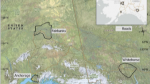
In this paper we modified an existing landcover dataset to better identify vegetation associated with wildfire and permafrost in Fairbanks, Anchorage, and Whitehorse over the past 4 decades (1984-2014) and make predictions for the next 4 decades (2024-2054).  We used an existing fire model called FlamMap and several statistical analyses to determine where future fires could be possible.

Read More

Wildfire hazard maps added for Mat-Su and Kenai areas

Residents in the Matanuska-Susitna and Kenai areas can assess their level of wildfire risk with new online maps developed by ISER research and associate professor Jen Schmidt as part of the Arctic Risks and Adaptations (AURA) project.

Read More

Learning from wildfire hazard maps and active wildfires

The Clear Fire in Interior Alaska has come within a half-mile of the Parks Highway, prompted evacuation orders for several communities, and is still just 22% contained. ISER associate professor Jen Schmidt has developed online maps residents can use to determine their level of wildfire risk. The maps also give insight to existing wildfires like the Clear Fire.